
Rebirth at Mount St. Helens

🌋 Rebirth at Mount St. Helens: Where Destruction Became Beauty
Just a short drive from Portland, Oregon lies one of the most awe‑inspiring testaments to nature’s resilience — Mount St. Helens.
Standing before it, you can feel the pulse of rebirth in the air, the quiet power of a landscape that refused to stay broken.
When the mountain erupted on May 18, 1980, it unleashed one of the most catastrophic natural events in U.S. history. The blast removed nearly 1,300 feet from its summit, flattened 230 square miles of forest, and sent ash drifting across 11 states. Entire ecosystems vanished in minutes.
The May 18, 1980 eruption lasted about nine hours, beginning at 8:32 a.m. when a magnitude‑5.1 earthquake triggered the largest landslide in recorded history and a lateral blast that reshaped the entire north side of the mountain. The sustained ash column rose 15 miles into the sky and carried ash across multiple states, marking one of the most powerful volcanic events in modern U.S. history.
Feel free to learn more about the eruption of St. Helen’s here: https://www.history.com/this-day-in-history/may-18/mount-st-helens-erupts-2

Standing here in the forest that surrounds the mountain, we are surrounded by green.
Wildflowers bloom where ash once fell.
Elk graze in meadows that were once moonscapes.
Birds sing in trees that grew from the soil of destruction.
Mount St. Helens didn’t just recover — it transformed.

PacifiCorp and the Parks That Keep the Spirit Alive
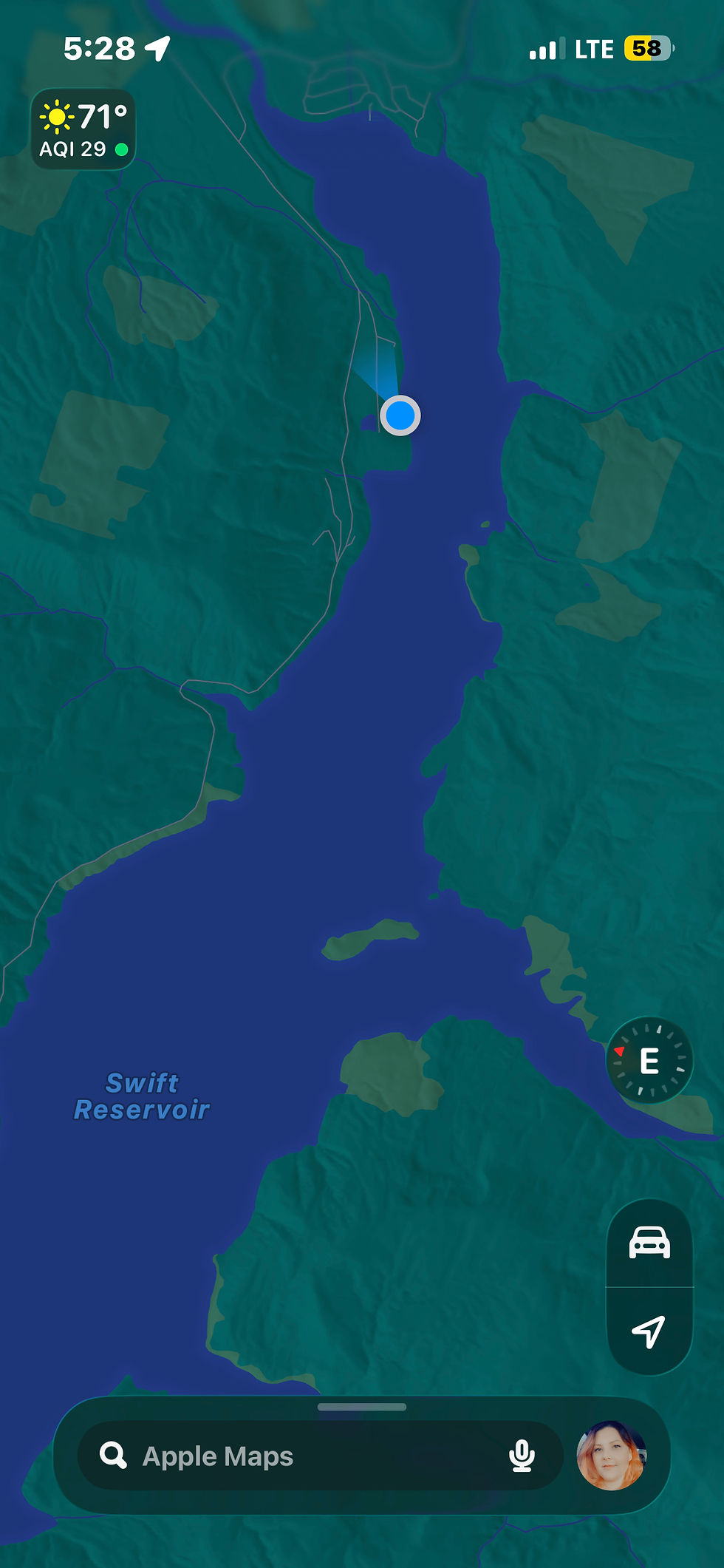
Our route took us through the Swift Reservoir, a shimmering expanse created by the Swift Dam and maintained by PacifiCorp, a hydro energy company.
What struck me most was how this company has turned their operations into something generous — parks, campgrounds, and day‑use areas that invite everyone to experience the mountain’s rebirth firsthand.
And on the day we visited?
Every single park they own and operate was free!
That meant David could relax knowing his Crohn’s symptoms were manageable with the abundance of restrooms, and I could handle my chronic pain with frequent stops to stretch and readjust. Every thirty minutes, we had a chance to pause, breathe, and take in the view — a rhythm that made the journey feel effortless.

For more information on pacificorp and their mission visit : https://www.pacificorp.com
To reserve a campsite at a Pacificorp location, check out this site: https://www.pacificorp.com/community/recreation/washington.html
Here is another wonderful little campground in the area: https://www.eaglecliffcamp.com/

Yep, that’s the dock - just laying there on dry land. As an important side note: ALL the docks were closed due to the lake levels being low.
I’d recommend checking the water levels before heading out! I will say however, there were plenty of boaters out on the lower lakes, such as Yale Lake.

Speaking of low water levels, Lake Merwin- as pictured above in September 2026, has experienced a water level drop to 229 ft, which is 10–11 ft below its full pool of 239.4 ft, and the combined Lewis River system (Merwin, Yale, Swift) still has 63 ft of total refill needed — a concerning deficit that signals unusually low seasonal storage.
Merwin Lake is currently sitting at 229 ft, which is 10.3 ft below its full pool elevation of 239.4 ft, according to USGS gauge 14219950. For a watershed that supports power generation, fish passage, and recreational use, entering October with this magnitude of storage loss is a warning sign — one that underscores how tightly water availability is now tied to shifting climate patterns and increasingly unpredictable inflow cycles.
A fact that David and I were alarmed to see, as the masssive amount of land exposed is concerning. The massive floating pipe that was anchored to the shore really aided in the visual of the changing weather conditions.
For me it highlighted the reality that I’ve come to experience all over the PNW and into the bread basket of America, shirking massive bodies of water and completely dried up river beds. Rivers that as a kid I would play in, now seem slated to be just a memory.

Not a whole lot of running water to be found. Which isn’t too surprising as Mount St. Helen’s was snow free and bare.

Small‑Town Charm Meets Mountain Majesty
We stopped at the Yacolt Store, a local gem with a hot plate that could rival any diner. I’ll admit it — I’m a sucker for a good chicken strip and Jo Jo basket, and that’s exactly what we grabbed for our picnic at Lake Merwin.


As a side note: At the lakes, some of the fancy restrooms were closed, leaving only a vault toilet situation. The lake parks also have seasonal operations and are barred off with a gate. Meaning winter exploration may mean having less accommodations and access.
Check out the Yacolt Trading Post here: https://share.google/HNE4JC1BYpvjF0Hi6
For more information about the town of Yacolt, WA out this site: https://www.townofyacolt.com/

Later, we stood in awe at Lake Yale, its glassy surface reflecting the sky like a mirror. And as we moseyed past the Ape Caves, the view of Mount St. Helens opened up before us — dynamic, commanding, and humbling all at once.
Sadly, due to my back injuries we did not stop off at the Ape Caves. But, I can see it clearly, as if just yesterday, a grade schooler, running down the trail, my classmates in tow. The narrow cave, the vast opening, the nooks, the crannies, and the uneven floor. The awe inspiring rock formations have a way of imprinting one’s subconscious. Oh, that and the twisted ankle that I sustained. 😂
A little back story about the Ape Caves and how it got its name.
A local Boy Scout troop called The St. Helens Apes, explored and mapped the cave in the early 1950s — So, no, despite the folklore it’s not from Bigfoot. 😢
The name has nothing to do with actual apes either, I know another sad fact, right?! And only indirectly connects to Bigfoot folklore. The cave was named after a Boy Scout troop whose nickname was The St. Helens Apes. They were among the first to explore and map the lava tube after its discovery.
The Boy Scouts adopted the name “Apes,” and when they explored the cave, the Forest Service used their nickname for the official designation.
The Cave Itself
Ape Cave is a 2.5‑mile lava tube formed about 2,000 years ago during the Castle Creek eruptive period of Mount St. Helens. It’s one of the longest lava tubes in North America and a major geological attraction.
Why People Confuse It With Bigfoot
A book on Sasquatch sightings once mistakenly tied the cave to the 1924 Ape Canyon story, causing decades of confusion. But the cave’s name is not based on that event — it’s purely a nod to the Boy Scout troop and their epic discovery.
Here is a link for more information on the Ape Caves: https://www.wta.org/go-hiking/hikes/ape-cave

A Boater’s Dream and a Traveler’s Awakening
The parks surrounding Mount St. Helens are a boater’s dream — pristine lakes, easy access points, and campgrounds that make you want to stay forever. But beyond the recreation, there’s something deeper here: a pulse of renewal that you can feel in your chest.
Standing there with David and Emma, surrounded by evergreens and the mountain’s silent strength, I couldn’t help but think — this is what healing looks like.
Not perfect.
Not painless.
But alive.
The Lesson of the Mountain
Mount St. Helens teaches us that rebirth isn’t gentle — it’s powerful.
It’s messy. It’s transformative.
And sometimes, it’s exactly what we need.
So if you ever find yourself craving perspective, take the drive.
Pack the snacks.
Roll down the windows.
And let the mountain remind you that even after the eruption, life still rises.
May your next adventure be an epic one!
Yours,
Vonnah


The power of termites and the will of the massive tree to survive. This is nature in action.
Comments